McKinnon Creek Detention Basin Failure Impact Assessment | WMS Engineering
Edmonton QLD, Australia

McKinnon Creek Detention Basin Failure Impact Assessment

WMS was engaged to undertake a comprehensive Failure Impact Assessment (FIA) for the McKinnon Creek Detention Basin
Monika Balicki
Questions? Get in touch today.
Monika Balicki

Client

Cairns Regional Council

Scope

Failure Impact Assessment (FIA) of detention basin

Impact

Completed FIA including updated dam rating
Monika Balicki
Questions? Get in touch today.
Monika Balicki

Client

Cairns Regional Council

Scope

Failure Impact Assessment (FIA) of detention basin

Impact

Completed FIA including updated dam rating

WMS was engaged by Cairns Regional Council to undertake a comprehensive Failure Impact Assessment (FIA) for the McKinnon Creek Detention Basin to ensure that the basin meets the Guidelines for Failure Impact Assessment of Water Dams (DNRME, 2018).

The project covered the following key aspects:

  • Development of hydrologic and hydraulic models for the Collinson and McKinnon Creek catchment;
  • Derivation of design rainfall and flood hydrology in line with the latest ARR 2019 guidelines;
  • Simulation of dam breach scenarios and determination of the Population at Risk (PAR) for these scenarios; and
  • Preparation of a certified FIA report in accordance with DNRME guidelines (DNRME, 2018).
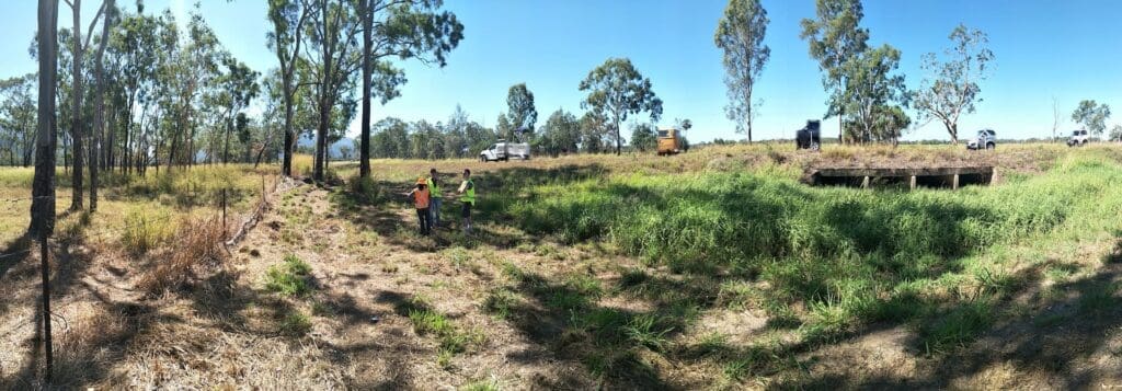
Collinson McKinnon Basin

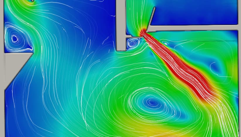
The hydrology was updated to ARR 2019. The hydraulic assessment of the downstream flood impact was undertaken using the latest version of TUFLOW and the original assessment for overtopping failure was undertaken utilising the QLD DNRME methodology.  The DNRME methodology, however, does not incorporate piping failure, and it was determined through initial discussions that piping around the basin outfall culvert may be the critical failure mechanism.  As such, the most up-to-date literature methodologies were used to determine breach parameters for piping failure and the hydraulic assessment was undertaken using the new TUFLOW 1D piping failure model.

Sunny Day Failure (SDF) was not considered for the basin as it was determined that the basin does not hold water for longer than 3-5 hours and would typically be dry in a SDF.

The number of Population at Risk (PAR) was calculated for each design flood event for four failure modes (overtopping of embankment, overtopping of spillway and piping failure at two locations). 

The critical failure scenario was determined to be piping failure following the alignment of the outlet structure and the PAR determined under this critical failure scenario was determined, with the basin rated under the Act, accordingly.

Related Projects

Water Level @ Bendigo Creek, Bay Street Golden Square
City of Greater Bendigo Council

Kangaroo Flat and Golden Square Flood Mitigation Study

A wonderful collaboration between government bodies, experts and the community that delivered effective solutions to mitigate future flood events.
Hay Street Pedestrian Bridge
Brisbane City Council

Hay Street Pedestrian Bridge Replacement

The objective of this project was to undertake hydraulic modelling and flood impact assessment to inform the design of the new bridge.
Marshall Precinct
City of Greater Geelong

Marshall Precinct Stormwater Management Strategy

The primary aim of the SWMS is to investigate the impact that the transition from rural residential land uses into predominantly urban, residential development will have on surface water within and beyond the PSP boundary.
Charters Towers river flood map
Charters Towers Regional Council

Charters Towers Retention Basin Modelling

Feasibility Assessment of Two Proposed Retention Basins
Road near Drummond Creek
Isaac Regional Council

Design of Drummond Creek Floodway

A new floodway design improving flood immunity whilst maintaining design speed requirements
Tenterfield
Tenterfield Shire Council

Tenterfield Dam Bathymetric Survey

WMS conducted a highly accurate bathymetric survey using a Sontek M9 ADCP to accurately determine the volume of water remaining in the dam and the volume of sediment.
Local Government map
Toowoomba Regional Council

Whole of LGA Flood Mapping

A Rapid, Low Cost Alternative to Detailed Flood Studies