Maryborough Flood Study | WMS Engineering
12-22 Nolan St, Maryborough VIC 3465, Australia

Maryborough Flood Study

Hydrologic and hydraulic assessment in regional Victoria
Amanda
Questions? Get in touch today.
Amanda Tobias

Client

Central Goldfields Shire Council

Scope

Hydrologic and hydraulic modeling, flood mapping, improved data, drainage mitigation options

Impact

The Maryborough Flood Study assessed flood risks, modelled design events, and explored mitigation options. It recommended effective strategies, early warning systems, and integrating flood resilience into local planning for future development.

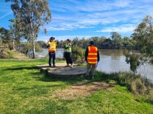
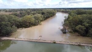
The Maryborough Flood Study aimed to assess and develop options to mitigate flood risks in the Maryborough township and Four Mile Creek catchment. This study utilised hydrologic and hydraulic models validated to historical flood events from January 2011 and December 1999. The study modelled a wide range of design flood events, including various storm durations and climate change scenarios, to ensure comprehensive flood mapping and risk analysis. Sensitivity tests were conducted for factors such as roughness changes, blockage, and downstream boundary conditions, ensuring the models accounted for variable flood behaviors.

Maryborough Site Visit 1Maryborough Site visit 2

Several flood mitigation options were explored, starting with preliminary assessments to gauge their potential effectiveness in reducing flood risks, followed by more detailed evaluations of feasibility, including cost analysis and benefit assessments. The study recommended that the council consider implementing one of the modeled strategies while emphasizing the importance of flood intelligence outputs and early warning systems for effective disaster management.

To support long-term flood resilience, draft planning layers were developed, with a recommendation for integration into the local planning scheme to ensure flood risk considerations are reflected in future development decisions.

Related Projects

Public Safety Business Agency

Esk Stormwater Management Plan

Toowoomba Regional Council

Condamine River Flood Study

Site Inspection of Farm Levee at North Star
SMK Consultants

Water Modelling Solutions and SMK Consultants

WMS and SMK Consultants Collaborate to have levees approved for farmers across rural New South Wales.
Washpool
Rockhampton Regional Council

Washpool Road Preliminary Design of Stormwater Infrastructure

WMS was engaged by Rockhampton Regional Council to identify and prioritise Council’s plan for future trunk infrastructure (PFTIs) for the Washpool Road area.
Latrobe Aerial View 1
Latrobe City Council

Latrobe Valley Stormwater Study

Urban stormwater study focusing on the townships of Traralgon, Morwell, Moe, and Newborough
Water Level @ Bendigo Creek, Bay Street Golden Square
City of Greater Bendigo Council

Kangaroo Flat and Golden Square Flood Mitigation Study

A wonderful collaboration between government bodies, experts and the community that delivered effective solutions to mitigate future flood events.
City of Gold Coast

Broadwater Master Plan