Jalarra Park Detention Basin | WMS Engineering
Jalarra Park, Passchendaele Street, Stratford Cairns, QLD, Australia

Jalarra Park Detention Basin

WMS teamed up with civil engineering firm Dryside Engineering to deliver the FIA and detailed design of the basin.
Monika Balicki
Questions? Get in touch today.
Monika Balicki

Client

Cairns Regional Council

Scope

Flood impact assessment and optimisation of a proposed detention basin design

Impact

Finalised design ready for construction and complementing the existing nature of the park
Monika Balicki
Questions? Get in touch today.
Monika Balicki

Client

Cairns Regional Council

Scope

Flood impact assessment and optimisation of a proposed detention basin design

Impact

Finalised design ready for construction and complementing the existing nature of the park

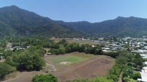
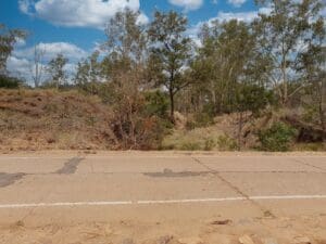
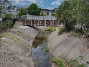
In 2020, Cairns Regional Council commissioned WMS to undertake a flood impact assessment (FIA) for the proposed Jalarra Park detention basin. WMS teamed up with civil engineering firm Dryside Engineering to deliver the FIA and detailed design of the basin. The objective of this study was to reduce the frequency of flooding on downstream properties while designing a drainage asset that complemented the existing nature of the park.

WMS updated the hydrologic and hydraulic models to ARR 2019. Numerous basin iterations were run to determine the optimum dimensions of the basin and outlet structure configuration. The implementation of the detention basin showed significant reductions to downstream flooding for both the frequent and infrequent events.

The hydraulic modelling results were used to size scour protection and complete the design ready for construction.

Jallara Park Drawing

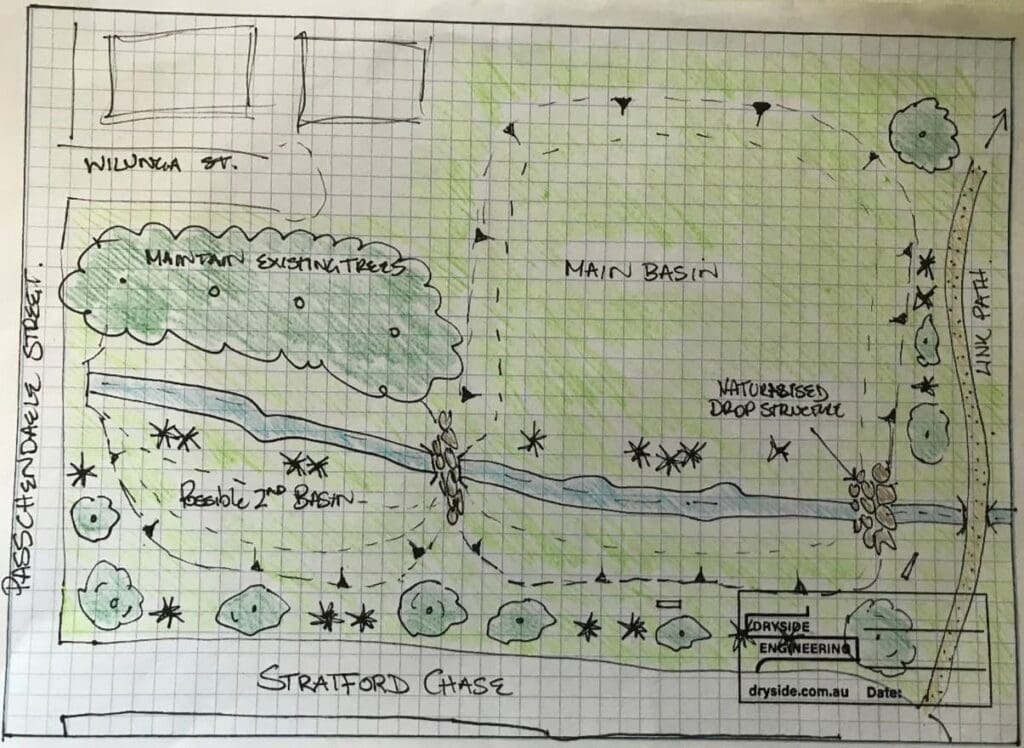
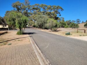
A landscape plan was produced which maintained the existing vegetation and included an upgraded walking path and benches to improve park facilities for residents. WMS also provided Council with landscape sketches and advice for the community consultation sessions which resulted in positive feedback regarding the proposed basin.

Related Projects

Local Government map
Toowoomba Regional Council

Whole of LGA Flood Mapping

A Rapid, Low Cost Alternative to Detailed Flood Studies
Charters Towers river flood map
Charters Towers Regional Council

Charters Towers Retention Basin Modelling

Feasibility Assessment of Two Proposed Retention Basins
murray basin
NSW Department of Planning, Industry and Environment (DPIE)

Murray Land & Water Management

NSW DPIE engaged WMS to update the Murray LWMP salinity modelling framework using contemporary platforms
TC Alfred coastal erosion
NSW Crown Lands

Flood Impact Assessment of Crown Lands Assets

Condition Assessments and Recommendations for Remediation Actions
Water Level @ Bendigo Creek, Bay Street Golden Square
City of Greater Bendigo Council

Kangaroo Flat and Golden Square Flood Mitigation Study

A wonderful collaboration between government bodies, experts and the community that delivered effective solutions to mitigate future flood events.
Marshall Precinct
City of Greater Geelong

Marshall Precinct Stormwater Management Strategy

The primary aim of the SWMS is to investigate the impact that the transition from rural residential land uses into predominantly urban, residential development will have on surface water within and beyond the PSP boundary.
Collinson McKinnon Basin
Cairns Regional Council

McKinnon Creek Detention Basin Failure Impact Assessment

WMS was engaged to undertake a comprehensive Failure Impact Assessment (FIA) for the McKinnon Creek Detention Basin