3907 Brand Hwy, Cataby WA 6507, Australia
Power Station
Surface water impact assessement

Questions? Get in touch today.
Blake MarxsenClient
A Major Power Generator
Scope
Surface Water Assessment to comply with Environmental Protection Authority guidelines for Inland Waters.
Impact
The assessment showed the Cataby Power Station project is protected against flooding, meets EPA water quality standards, and faces minimal environmental impact under current conditions. Future changes may require re-evaluation.
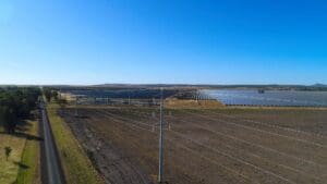
The Cataby Power Station is an upcoming 400 MW fast-start, open-cycle gas turbine facility set to connect with the South West Interconnected System (SWIS). Located approximately 200 kilometers north of Perth on a 20-hectare plot of cleared agricultural land, the project involves constructing infrastructure, including an access road, on up to 10 hectares of the site.
Pending approval under Part IV of the Environmental Protection Act 1986, the development is designed to comply with strict environmental standards. The project aims to efficiently manage flood risks and stormwater, safeguarding local water bodies and ecosystems in accordance with EPA guidelines.
Related Projects
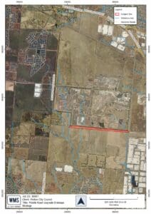
Melton City Council
Middle Road Drainage Strategy
Comprehensive drainage strategy and flood impact assessment