SWIS Peaker Project Flood Impact Assessment

Client
Scope
Impact
Client
Scope
Impact
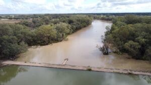
Alinta Energy Development Pty Ltd is planning the SWIS Peaker Project, a 400 MW open-cycle gas turbine power station near Cataby. WMS conducted a comprehensive Surface Water Assessment to evaluate flood risk, stormwater management needs, and overland flow patterns within the 20-hectare project area. The primary objective was to ensure the optimal placement of critical infrastructure while minimising environmental impacts and safeguarding the site from potential flood hazards.
The assessment involved hydrologic and hydraulic modeling using HEC-HMS and HEC-RAS software, examining both pre-development and post-development conditions for flood behavior analysis. Detailed modeling outputs, including peak water depth and velocity maps, confirmed the site’s natural protection from external floodwaters, such as those from Cataby Brook and Minyulo Brook. Additionally, catchment analysis and water quality evaluations aligned with Environmental Protection Authority (EPA) Inland Waters guidelines, ensuring minimal impact on nearby water resources.
The findings demonstrated that overland runoff within the site could be effectively managed through internal drainage systems without significant risk of downstream scour or sedimentation. While future changes to the Iluka mine site’s hydrology could necessitate further assessment, current conditions indicate the project’s alignment with flood risk management best practices and environmental sustainability goals. These results provide Alinta with the necessary insights to proceed confidently with the engineering design phase while ensuring regulatory compliance and long-term water resource protection.”
Related Projects

Whole of LGA Flood Mapping